Northern Ecology
What's This Rock 3? Southern North Shore’s Geological Story
Course Overview
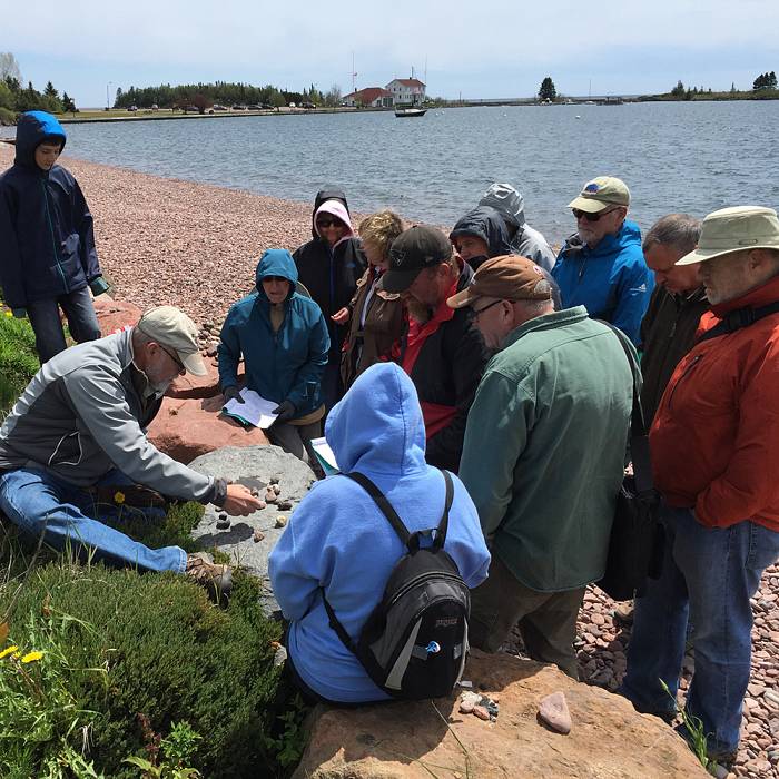
How many times have you walked along a cobbled beach or a rocky ledge along the North Shore and wondered, “What’s this rock? Where did it come from? Why is it here?” Lace up some sturdy footwear and head into the field to be immersed in the fascinating geology of the southern part of Minnesota's North Shore with University of Minnesota Duluth emeritus geology professor Jim Miller. This is a third part of the “What's This Rock?” series* that will focus on “reading the rocks” between Silver Bay and Two Harbors. Like the other What's This Rock courses, the geology of this area tells the 1.1 billion-year-old story of fire and ice that created the Lake Superior basin. An introductory lecture on Friday evening (at the Tettegouche State Park Visitor Center) will introduce you to basic geologic terms and principles that will help us interpret the geologic story of the area. On Saturday, we will visit various rock exposures between Two Harbors and Silver Bay that illustrate the story of lava eruptions that spilled across a vast barren landscape over one billion years ago. We will also investigate sediments and landforms formed by enormous continental glaciers that carved out the Lake Superior basin over the past two million years. On Sunday morning, we hike around Tettegouche State Park and examine its diverse geology. Students aged 16+ may register for this course independently. *The three courses in the "What's This Rock?" series do not need to be taken sequentially nor are they prerequisites to each other. Students aged 8-15 may register with a full-paying adult. The youth student will receive a 25% intergenerational discount; call to register.
This course will not be based at North House Folk School. Instead, the instructor will meet the students at Tettegouche State Park Visitor Center, which will serve as the homebase for the course. Students are encouraged to make lodging arrangements in the Tofte/Silver Bay/Two Harbors area. The class will carpool to sites in the area.
Ability/ Skills required: Most of the field trip stops for WTR3 will be visiting roadcuts along Highway 61 or rock exposures along or near the shore. Most of these stops involve short hikes, less than 1/4 mile, along gravel footpaths with mild to moderate inclines, on irregular bedrock surfaces, or along cobbled beaches. The Sunday morning field trip involves a more challenging terrain. We will make a 2-mile hike along the shoreline between Shovel Point and the mouth of the Baptism River that involves significant changes in elevation (+/- 500’). Because of the rigor of many of these field trip stops, sturdy footwear is strongly recommended and people with physical mobility issues are discouraged from enrolling.
Required Tools
- Sturdy footwear
- Rain gear
- Hat
- Water bottle
- Lunch for Saturday
Optional Tools
- Camera
- For safety reasons, rock hammers are not allowed
- All participants will be given a high-visibility orange vest to wear during highway field stops
